San Francisco & Desolation Wilderness - July 2025

A Lake Built for the Greek Gods.
By this point, you should know us and our desire for adventure. Well, last year (2024), two of our best friends hiked the Pacific Crest Trail — 2,650 miles from Canada to Mexico, through Washington, Oregon and California — for their honeymoon. That’s perhaps a little too much adventure for us to tackle, but they saw and experienced some incredible things and inspired us to explore more of California’s backcountry.
My sister moved out to San Francisco a couple years ago and she conveniently took her European vacation the week we were in San Francisco a couple years ago, and she’s been making a list of all the places she has been wanting to show us. We figured we would visit Selena in SF, see my grandparents and uncle in Sacramento, then head to the wilderness for some mountainous respite.
Chris booked us permits for Desolation Wilderness, camping in the Grass Lake zone for the first night. Our plan was to make it to Lake Aloha, based on feedback from our PCT friends, Caroline and Ed, which Caroline described as a lake built for the Greek Gods. When we backpacked Alice Lake in Idaho a couple years ago, we spent a rest day at the lake just chilling and swimming, and had something similar in mind for this trip.
Day 0: NJ to SF
Kevin and I flew out to SF on July 4th. Our flight left at 4PM and Selena picked us up from SFO around 7:30PM (our first time in her car that she purchased three years ago!). She was eager to start our sightseeing tour and brought us to see the Painted Ladies in twilight. There is a park just across the street from the Painted Ladies, and the span of cityscape behind them. The Painted Ladies as a site are best known because of Full House (for our generation anyway), but the term Painted Ladies refers to the Victorian style house that is painted in three or more colors to accentuate the architecture. There are plenty of astounding buildings of this style and many others that we noted as we drove around the city.
Selena dropped us off at our hotel in Japantown, Hotel Kabuki, so that we could check in and drop off our luggage. San Francisco feels relatively safe (more on this later), but is known for car break ins. It is good practice not to leave anything in your car. Selena even says she always keeps the back seats folded down so that when people peer into the car, they can clearly see into the trunk space that there is nothing there, and they don’t just smash your window to see if you have anything in your trunk worth stealing.
Hotel Kabuki is actually connected to the West Mall of Japan Center, and has a restaurant on site that is apparently Michelin starred, though unfortunately we did not have the opportunity to dine there. The style and decor of the hotel is Japanese with the calming natural wood tones and that chic jazzy vibe, featuring vibrant artwork that is Japanese-inspired and a rock fountain with koi in the garden. The carpets in our hotel room were reminiscent of tatami mats.


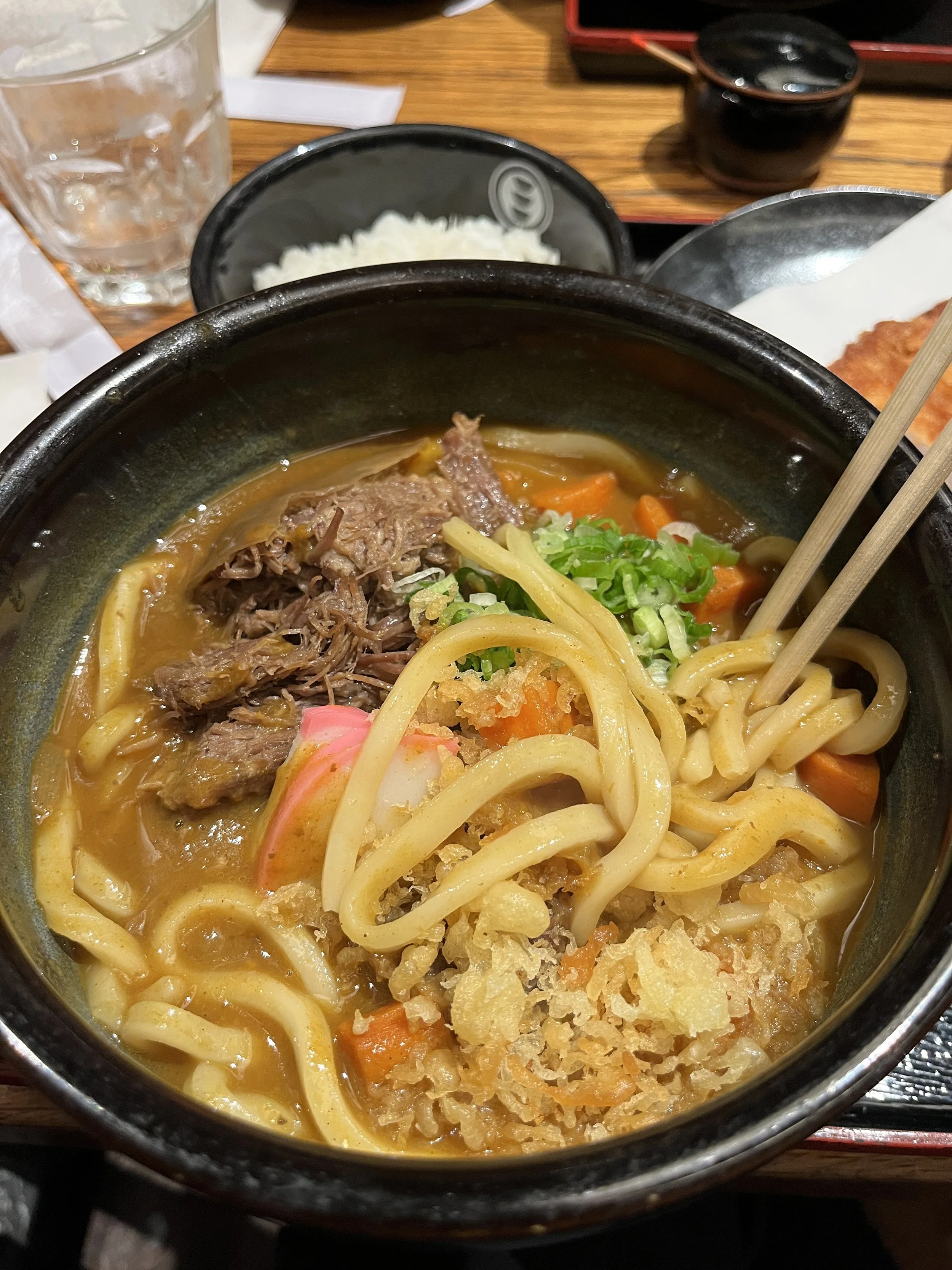
It seems to me like most of the time when I talk to my sister on the phone, she is either in Japantown, going to Japantown, or just left Japantown. It was inevitable we start our trip here. There is a large pagoda, which unfortunately is under construction and surrounded by scaffolding. I imagine it is extremely picturesque when you could see it in all its glory. The majority of where we were was in the Japan Center mall. It doesn’t quite feel like you are in Japan, but they do a good job with the decor. We went to Udon Miguzo for dinner. There was a short wait of 5-10 minutes, but it was so short that we hadn’t even decided what we wanted to order from the menu posted outside by the time our table was ready. I ordered the beef sukiyaki udon, Selena had katsu curry udon and Kevin had spicy niku bukkake udon. We shared gyoza tempura and maitake tempura. All the food was delicious and comforting.


It was slightly after 9PM and we packed our leftovers to head to Selena’s car. SF was having fireworks shows at 9:30 and Selena planned to take us to a park on a hill for the best vantagepoint. It seemed like everyone had the same idea, though. There was a lot of traffic. People were getting out of their Ubers on the side of the road and walking the rest of the way to their destination. After driving around for quite some time looking for a place to park with no luck, we decided to watch from the road. SF is very hilly - it’s not just that one section of Lombard Street - so we parked at the top of a hilly intersection that had a nice view of the fireworks. After the fireworks show concluded, Selena dropped us back at our hotel to rest up for our first full day of adventure.
Day 1: San Francisco, Highway 1 and 17 Mile Drive
Kevin and I woke up relatively early for California standards, to a number of cafes Selena recommends. She was not awake yet, so we got ourselves ready and decided to walk to her area, where most of the cafes were located. It was 8AM or so, and the city felt dead - almost no cars out, just a handful of people. To be honest, he and I did not sleep well because people were setting off fireworks until about 4AM, so we figured everyone was sleeping in after a night of partying. We walked through what could be perceived as a shady area - older looking buildings with locked gates and bars over first floor windows. If it weren’t for all the other Asian people walking around, I might have felt differently, but I felt safe, just thinking the buildings were old and the place had history. At one point during our walk, we saw a man kneeling in the middle of the sidewalk with his forehead on the ground and butt in the air. This was our first encounter with nefarious activity. But again, there was another older Asian lady walking just ahead of us, so we crossed the street and continued walking.
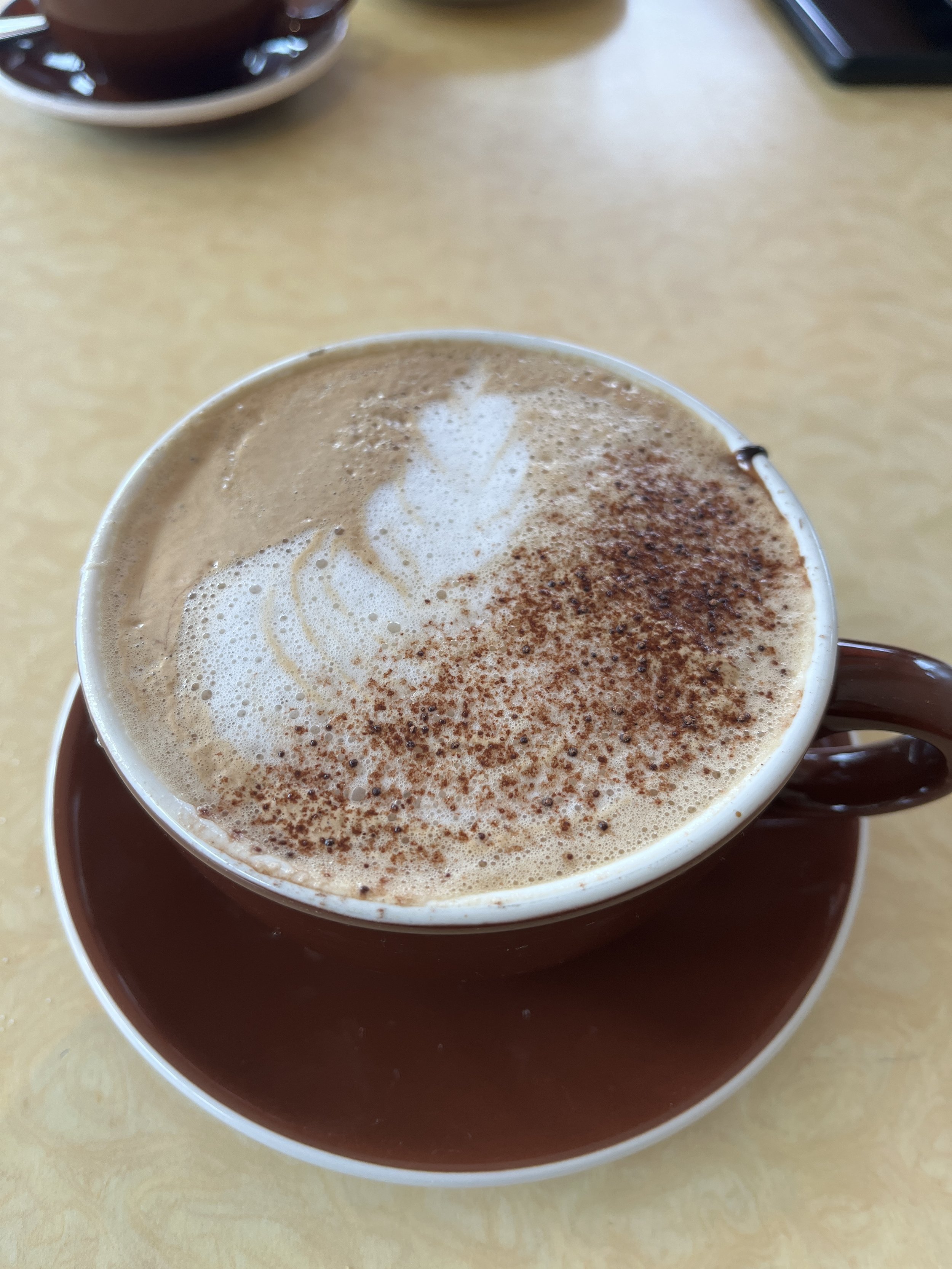
We made it to Cafe du Soleil just a few minutes before Selena. We were ordering when she appeared behind us, and the men working at the cafe guessed what she wanted - I guess she’s a regular! I had a cappuccino and the chocolate hazelnut croissant (Selena’s recommendation). Kevin had a cappuccino and a jambon et fromage croissant, Selena had a raspberry mocha latte (not on the menu) and a turkey brie croissant. In my opinion, the chocolate hazelnut croissant was too sweet, even with a cappuccino.


After our breakfast, we stopped by Selena’s apartment and got the grand tour before embarking on our adventure for the day. She took us down Highway 1, which runs alongside the California coast, cutting through a couple of small towns. There was a surprising amount of farmland (hay bales) and the area is apparently known for strawberries. We stopped at a roadside stand to buy some strawberries. They also sold other types of produce like avocados, and had garlic chips to sample. They weren’t “chips,” per se, but rather full garlic cloves that had been dried or dehydrated, we aren’t sure how they were prepared, but they were crisp all the way through and delightful!


Our scenic drive took us to Carmel where we stopped to pick up lunch at a local fish market, Sea Harvest Fish Market - fish and chips and clam chowder. Selena took us to another one of her bakeries, Lafayette Bakery and Cafe, but it was almost 2PM, they were getting ready to close and most of the goodies had been sold out. Kevin got a baguette, and because it was almost closing time, he got a second one for free!
We hopped back into the car and continued onward to 17 Mile Drive, which is a scenic drive through Pebble Beach on the Monterey Peninsula. It is $12.25 fee per vehicle to enter the area, but there are many nice stops along the way to enjoy. It looked like there was also a trail that paralleled the road, for pedestrians to walk instead of drive. In this area is the renowned Pebble Beach as well as three or four other golf courses. At some of the pull offs, we saw seals, different types of birds and trees. One of the highlights was called the Lone Cypress, and was even on the front cover of the pamphlet we got when we entered, so it must be iconic!


Selena had more to show us down south, but it was a long day of driving and we decided to head back to SF. On the way, we stopped in Mountain View, which is the first place Selena lived when she moved to California and played a big role in what made her fall in love with the area. We went to a park that she used to walk around during lunch, went to her old workplace (and discovered her old boss sold the practice, it’s no longer a PT office!), walked around the neighborhood where she used to walk at lunch talking to me on the phone, drove by her old apartment. She took us to the “secret spot” that only the cool kids know for the best view of sunset (the only other people there were a couple of kids smoking weed). The downtown area is so cute! There was corn hole and live karaoke on the street. We went to a Vietnamese place that Selena hadn’t been to before, called Photochou999. I could definitely see why she enjoyed living there.
Day 2: San Francisco to Sac
One of the things we wanted to do while in SF was go for Dexa scans. Selena had gone six months prior and it gives a lot of insight into health like bone density, amount of fatty vs lean tissue, visceral fat, etc. We figured it would be nice to have baseline, and it’s affordable and accessible in SF. Kevin and I had scheduled our Dexa scans for 9AM and took a Lyft from our hotel. It was located in Chinatown, and Selena’s original idea was that we could meet in Chinatown when we were done. The scans were fast (I think seven minutes each), and they got our results to us within the hour.
After our scans, we weren’t sure if Selena was awake yet, so we started walking toward the water and figured we would get coffee and explore a bit. It was much more lively by the wharf this morning, with lots of people out for their morning jogs, compared to the previous morning. We found ourselves by the Ferry Building. There was a window selling coffee, which no apparent store name advertised and no corresponding business on Google. Only a few shops were open, those selling food. Inside of the Ferry Building, there was a coffee shop, Blue Bottle, with a huge line - seemed to be the only place in the area of coffee, with the exception of that window outside of the Ferry Building. Upon closer inspection, there was a sign, of a blue bottle, by the coffee window - a satellite coffee access point!
We wandered a little more while we waited for Selena. There was a cable car/train/trolley stop nearby (she calls them different things but they all look the same to me). Across the street from the Ferry Building was a small market and a giant see-through art piece of a woman. This symbolizes female strength and liberation. Apparently throughout the city are similar works of art on display; we saw one on the highway out of the city.
By this time, Selena made it to us and we ordered Blue Bottle Coffee from the window with no crowd. While we had explored inside the Ferry Building, the aroma of empanadas called to us. We went back to purchase Argentinian empanadas from El Porteno - mushroom for me. We found ourselves a bench outside by the water overlooking Alcatraz and the bridges.


It was a gorgeous morning. Selena drove us to Coit Tower, which is named after a woman, Lillie Hitchcock Coit, and was built in 1933 after she passed away and left money to beautify the city she loved. The main level is adorned with murals that depict the history of the city. At the top of the tower is an observation deck that offers panoramic views of the city and the bay, but the 90-year old elevator was broken and we weren’t in the mood to climb 13 flights of stairs for $10 a person the day before embarking on a backpacking trip. Still, the area offered wonderful views of the city, even without going to the top of the tower.


Selena brought us back to our hotel so that we could check out and bring our bags to her apartment. We stopped at another one of her favorite bakeries, one that would soon become one of my favorites as well, Le Marais. I had a regular croissant au beurre, and they were not kidding about the beurre! It was perfectly crisp and flaky, and I got a pleasant little squish of butter with every bite. I was so enamored by my croissant that I don’t even know what Kevin and Selena got.


Our next SF stop was Golden Gate Park. It’s like the Central Park of San Francisco. It was too large for us to explore it all in the time we had, so we went to enjoy the Japanese Tea Garden. Apparently it is free entry for SF residents and $15 for non-residents. They did a really good job embodying the feel of a Japanese garden, complete with a buddha, bridges, koi, momiji, cherry blossoms in the spring, zen garden, pagoda, tea house and gift shop. It definitely gave us the urge to book a flight to Japan, and plenty of inspiration for our backyard transformation! There is a tea house where you can order tea or snacks. Kevin saw yakionigiri on the menu and wanted to try it. It looked nice - deep golden brown color in the perfect triangular shape - but it turned out it was just rice glazed with soy sauce. There was nothing yaki about it (yaki means grilled). Needless to say he was disappointed, but what can you expect from a touristy tea house in America.
By the time we were done at the Japanese Tea Garden, it was 1:20. We were supposed to be in Sacramento to meet up with our family at 4PM, a two hour drive away, and Selena still had to pack for our backpacking trip! We went back to her apartment so she could pack. Kevin and I hung out, we had leftovers for lunch and hit the road again probably around 3:30. We made it to the hotel to check in right around 5:15, pulling in right behind our uncle and Chris, who had flown into Sac that morning and spent the day with our uncle. We dropped off our bags, settled into our room, and went to dinner with our grandpa at 6. After dinner, the four of us and our uncle hung out at an outdoor bar to catch up since we hadn’t seen him in a couple years. When the bar closed at 10, we said goodnight and went back to our hotel for us to re-distribute gear and re-pack for the adventure ahead!
Day 3: Sac to Desolation Wilderness, Grass Lake
We woke up in the morning and did our final packing, filled our water bladders, checked out of the hotel and had a few last minute errands to run. First was a stop to the grocery store to pick up trail lunch and wipes. For us, trail lunch is a pack of tortillas to share, and some tuna packets - it’s protein strong and easy to assemble and eat on trail. We also needed our obligatory caffeine, and Selena found a place called Golden Bean Cafe on Google. It was (somewhat awkwardly) located in an office park, and a little difficult to find. Inside, it didn’t look like much at all, but the drinks were surprisingly good. Around 11AM, we finally hit the road.
We pretty much followed Route 50 across the state for two hours, passing cute small towns and driving alongside a river as it winds through the eastern part of California. At 1PM, we reached the town of South Lake Tahoe and stopped for lunch. One of the first places that showed up on Google was the Getaway Cafe, which was on the outskirts of town, had good reviews and sounded perfect for us. Someone in our car accidentally called it the Gateway Cafe at first and among us, that name stuck - it seemed appropriate being at the edge of town and the gateway to the wilderness.
The Getaway/Gateway Cafe closes at 2PM, so we made it with perfect timing to enjoy lunch. Kevin and I eat had fish tacos, and Chris and Selena shared a French dip sandwich. We used the toilet here for the last time for the next few days.
Our hike started at the Glen Alpine Trailhead, about half an hour southwest of South Lake Tahoe. The road becomes a narrow road that overlooks Fallen Leaf Lake on one side and has mansions on the other. This road was tricky to navigate because you have to pull over to allow opposing traffic through, but it was quite nice (as a passenger) to admire the lake and the houses. Past the lake, the road becomes even more narrow and windy - but gently, not like one of those roads that I’d fear carsickness.
We were lucky enough to find a prime parking spot - there weren’t many spots left. There are pit toilets at the trailhead, and a dumpster for trash. We changed into our hiking boots, applied sunscreen and bug spray, finalized our packs and weighed them. The general guideline for pack weight is that your pack should weigh 20% of your bodyweight. Unfortunately for us, exactly zero out of the four of us had packs that followed the guidelines. (If you are an optimist and like the glass half full, the upside is that we camp in a way so that we are prepared - especially for cold after our first backpacking trip in Yosemite - we eat well and we spoil ourselves with luxury items). Selena’s pack was the lightest at 36.48lbs, then was mine at 38.52lbs, then Kevin’s at 47.76lbs and finally Chris’s at 48.50lbs. We each carry our own clothes, sleeping pad and sleeping bag/quilt, meal coozies (made by Kevin) and spork, headlamp, chair (luxury, I told you!). Between me and Kevin, we split our gear. He carries our bear can (and therefore food), and I carry our tent. Other gear - like the water filter, stove, pot, cups, medical kit, poop trowel - get placed in whatever pocket possible.
We found the bulletin board with the map and information, but it took us a while to find the actual trailhead. (Spoiler alert: it is right behind/to the right of the bulletin board). It was 15:22 and 91 degrees when we actually started hiking. The beginning of the trail was very rocky, with big gravel, which I feel is the worst type of terrain. The fist-sized rocks slip under your feet like little gravel, and are big enough that you could twist an ankle. It was a good exercise in ankle control, but this part of the trail was not enjoyable for me. I knew it wouldn’t last forever, but it probably composed the majority of the first mile of trail. The trail took us past Glen Alpine Springs, which is a historic resort that hosted John Muir, complete with an Assembly Hall and games.


Once we reached the true trail, the terrain improved. There was an area before we reached Desolation Wilderness that was heavy with mosquitoes, but the rest of the trail a nice steady incline with a couple of switchbacks, nothing crazy. The entrance to Desolation Wilderness was much further in that I anticipated, about a mile and a half from the trailhead. Soon after, about a quarter mile, we reached the split for Grass Lake and Susie Lake. Since our permit was for Zone 35, we had to camp in the Grass Lake Zone for the first night, so we took the Grass Lake trail to the left. It was another mile or so after the split until we reached the lake. According to AllTrails, it is only about 700ft elevation gain in 2.3miles, and Kevin’s Garmin agreed with this. Kevin’s Garmin read that we started at about 6600ft and ended at an elevation of 7177ft.


Despite my pack being over 10lbs what is ideal, I felt strong the first day. It was a pleasant surprise! I had not been training consistently at all lately and am probably the least fit I’ve been in the past five years (just a lot going on with the new house, projects that I prioritize my time for over training). I did not feel out of breath or slow - in fact, Chis even said I was keeping a strong pace when I was leading, and Chris is a fast hiker!
The campsite was chose was flanked by rocks. On one side, the rocks were overlooking Grass Lake, and on the other side was the trail. In the middle, we were in a no-wind-zone. We scoped out a couple other campsite options that were in a more wooded area, with shade, shrubs and also more mosquitoes. We were the only people around the lake. In the wooded area, there was a tent that was collapsed, but no humans. At first, I figured maybe they were day hiking and left their tent, but as night fell, we didn’t notice anyone come by. We hope they are okay.


Our site was sunny at first while the sun was up. Between our rocks, we had a view of the water. The first thing Selena did when we put down our packs was jump in the water. The rest of us started to set up camp. It was shortly before 6, and we wanted to pitch the tents and start cooking dinner before nightfall. We started dinner at 6:30. I had Chicken Coconut Curry by Peak Refuel (850 calories, 44g protein). On our previous backpacking trip, Chris had this meal and it was delicious. Even after years of anticipation, it did not disappoint. Peak Refuel has become my favorite backpacking meal company - they are delicious, and protein heavy, perfect after a day of hiking.


After dinner, we took our chairs to the top of the rock and relaxed at the waterfront. As the sun went down, the mosquitoes came out to play. In doing our research prior to the trip, we had read that Desolation Wilderness is swarmed with mosquitoes in June and July. I had seen videos of hiker influencers in the past swarmed by mosquitoes and they had head nets. In preparation for our trip, Kevin and I ordered head nets to keep any mosquitoes away from our faces. Chris and Selena, on the other hand, opted for full mosquito suits. Selena’s even came with mittens and socks - she looked like a Teletubby. To be honest, they were annoying, but not that bad - the mosquitoes, that is. By the end of my trip, I had put on my head net twice in the four days, and had only six bites. Everyone else had more bites than me, despite wearing their mosquito suits for longer. I will add, though, that I used bug spray on myself (Ben’s), and had treated my clothes with permethrin years prior. Not sure what the magic was, but usually I am under attack.
We enjoyed the peaceful view from the top of our rock from when we finished dinner to around 8:30, just after the alpenglow disappeared. The sun was still setting as we got ready for bed. We had to find a place to keep our packs and our bear cans, and a place to use the bathroom that respected Leave No Trace (LNT) principles. I went to sleep at 10PM that night.


Day 4: Grass Lake to Lake Aloha
I woke up at 7. The night was warm. We had anticipated cold temperatures overnight; the forecasts showed in the 40s, so we packed our wool base layers, long sleeves and long pants, a cold gear fleece, our sleeping bag liners - but we didn’t need it! Kevin and I both slept in just our base layers and our quilt. In the morning, it was 54 degrees in the shade, paired with the crisp mountain air, it was a wonderful way to start the day.
We got breakfast started. I had Peak Refuel Strawberry Granola (530 calories, 23g of protein). Today was going to be our toughest day, with the most mileage and elevation gain. We planned to make it to Lake Aloha, which was about a six mile hike. I wanted to make sure everyone was fueled up properly. At 8:30, I reviewed the plan (hope) to leave at 10, to give us ample time to make our way to Lake Aloha with time to enjoy the lake, while also giving us plenty time to pack up camp and get ourselves ready. After breakfast, I started pumping water to refill everyone’s bladders. Around our site, there were so many dragonflies and butterflies that were out to play! As I was perched on a rock pumping water, I noticed a bunch of little fish, about 4-5 inches long, in the lake. After our last backpacking trip to Alice Lake, Kevin had purchased a collapsible fishing rod and we had joked about him bringing it, especially after Caroline and Ed’s friend had a rod while they hiked the PCT and they fished in several lakes. Kevin didn’t bring it because he says he doesn’t know how to fish, and I will say I’m glad he didn’t bring the extra weight because the fish were so small.


While we were packing up camp, my sister (in true Selena fashion) disappeared without notifying anyone. She went on the other side of the rocky cliff to chill by the water while we packed up camp and got ready to head out. After calling out to her at minimum six times, she popped her head out from behind the rock and told us she was waiting for us. My dear audience, please note, when you are in the wilderness, with no cell reception or way of communicating as we are programmed in today’s society, please tell someone when and where you are going before you wander off on your own. There are dangerous people out there, but nature too can be unforgiving at times. Aside from the fact that we were packing up for everyone while she was “waiting for us” and then we had to subsequently wait for her to pack up, for safety reasons above all else, notify your team.
We finally hit the trail at 10:57, and it was 95 degrees already. About 40 minutes into our hike, Selena declared she wanted to pump water, even though there would be many more water crossings to come (which we knew from the map), and there was plenty time to pump water in the morning before leaving camp. The three of us waited in the mosquito infested woods while she pumped water. Shortly after this water crossing, we hit the junction between Grass Lake and Susie Lake.


The switchbacks were not bad whatsoever. There were two sets of switchbacks, the first was very exposed, the second had some shade. The trail to Susie Lake is more shaded and more gravel. The big gravel was back, again, hard on the ankles, especially with the elevation gain. We stopped for lunch by a little waterfall just off trail at 1PM. There was a large cluster of little blue butterflies and normal neutral colored butterflies on the rocks next to the water.


At 1:40 we hit the trail again. First we came to Susie Lake, really quaint and peaceful. The trail brought us from the east side of Susie Lake, southward to the west side. Shortly after passing Susie Lake, we saw another lake and got excited - could it be The Lake? The Lake for the Greek Gods? From our vantagepoint on the trail, the ground was littered with wildflowers. There was a break in the trees that teased a view of water. To our left, there was also a stream that had carved out snow, leaving an igloo tunnel, even though it was July!


As it turns out, we had not reached Lake Aloha, but Heather Lake, which is gorgeous. The trail is now large gravel, but packed so it doesn’t roll or slide under your feet. To your right is a big, steep hill of gravel that is like an extension of the trail. To your left is the lake - vast, dark blue, with a little island propped in the middle - reminiscent of Spirit Island in Jasper NP (not that I’ve ever been there, but from photos). It didn’t appear like there was anyplace to camp along Heather Lake, if you’d wanted to; it was all too rocky.


We continued climbing up and up until we saw it. You couldn’t mistake it for anything else. Lake Aloha and it was indeed glorious. Magnificent. We made it. It was just after 4PM. We had read that the further south you go, the more picturesque and fewer mosquitoes there’d be. Selena and Chris scouted sites while we watched the packs. Our walkie talkies came in handy for this purpose, a lesson we had learned last backpacking trip. We brought our packs over to where they were, which was just below another group.


Kevin and Chris scouted a little more and found an area by a little pond, and we moved further up the mountain. Kevin and Selena went to pump water (read: Kevin went to pump water and Selena went to play in the water) while Chris and I planned to get camp set up and start dinner. It was so windy where we were, though, that we were afraid if we set up the tents and we weren’t in them, they’d fly. And we couldn’t start dinner until we had water. We used the opportunity to scout a little more. A couple concerns about being so close to the little pond was 1) mosquitoes, and 2) we’d have to walk further to use the bathroom, to ensure we were adequately far from a water source. Since we were now high on the mountainside, we could easily spot other candidates. Kevin and Selena came back up and said they found other areas that might be more appropriate, and they coincided with what Chris and I thought, so we moved. It was still windy all the time, didn’t let up. The benefit of this was that there were almost zero mosquitoes because the wind was so strong - no need to break out the mosquito suits!


It was 6:15 by the time we had set up camp and started dinner. I had Peak Refuel Chicken Pesto Pasta (920 calories, 43g protein) and Kevin had Peak Refuel Beef Stroganoff (810 calories, 41g protein). We were still hungry, so we split Peak Chicken Teriyaki (580 calories, 40g protein) since we had accounted for a camp lunch this day and not a trail lunch and we had extra. The Chicken Pesto Pasta and Beef Stroganoff were delicious and satisfying, but the Chicken Teriyaki left much to be desired. By the time we were done eating, the sun was still out, but starting to descend behind the mountain. Kevin said he was tired and ready for bed. It was 7:30, but was a big day. We packed up the bear cans and our packs, and got ready for bed. We were in the tent by 8:10.


I definitely didn’t feel as strong this day as I had the day before. I wouldn’t say I felt weak, but there were a couple points between Susie and Aloha that I felt like I needed to take a break. That being said, we took a lot of breaks the first day, and very few the second day. At the end of the day, when we checked mileage and altitude, I realized that the altitude probably played a significant role in my performance. At our campsite at Lake Aloha, Kevin’s Garmin read we were at about 8200ft, compared to the 7100ft at Grass Lake. I especially felt it climbing up the mountain when I went to pee - I’d feel tired quickly, when I wouldn’t ordinarily. My Fitbit tracked 9.44mi and Kevin’s Garmin tracked 9.2mi; however, according to AllTrails, what we covered was 5.5mi. Chris thinks it might be because these trackers are based on the number of steps we take, but our strides are shorter when carrying our packs.
In any case, we turned in early, hoping for a good night’s rest and recovery.
Day 5: Lake Aloha to Susie Lake
As it turns out, it was not a very restful night. Well, it was for me because I sleep with an sleep mask and ear plugs. But for the rest of the group, the wind kept them up all night. It was certainly windy, rustling the tent all night long. Kevin thought our tent was going to take off at any moment, even with us inside it! Chris reported he recalls about all of 3-5 seconds when the wind ceased, in the entire night. Our initial plan was to use this as a rest day, zero mileage, to enjoy the lake and relax. We unanimously decided to move to Susie Lake, in hopes for better conditions.
Chris was up early (say what! ) before 6 and saw the sunrise from the mountain ridge that has Lake Aloha on one side and Heather Lake on the other. I woke up at 7 naturally (and maybe a little because I needed to pee). Because I had worn ear plugs, I didn’t hear him get out of the tent earlier and jumped when I got out of my tent and saw him sitting there in the area we had designated our “kitchen”. He was sitting soaking in the views - it looked like he was either deep in thought or sleeping with his eyes open, who’s to say!


One of the things that a lot of people have a hard time with is peeing and pooping in the wilderness. This does not bother me whatsoever, but I had hesitations going in the middle of the night here at this site because of how sleep the climb was and how strong and persistent the wind was, and the fact that I had felt the effects of the altitude earlier (in that I’d get tired quickly - heart racing, muscles burning - not altitude sickness). To do it in the middle of the night, in the dark with a headlamp, with no one knowing you left the site to go, seemed dangerous. I’m sure it would have been beautiful to see the lakes in the moonlight from high above, but to me, not worth the risk, even for my bladder.
Chris and I got the kitchen set up at a leisurely pace - brought over the bear cans, the stoves and fuel, etc. - and sat for a while enjoying ourselves. Kevin got up, and we talked about our change in plan to head back down to Susie Lake today instead of spending it at Lake Aloha. In the morning, now that we were awake, the wind had died down significantly - to the point that there was no wind at times, but that also meant the bugs came out. There were mosquitoes, yes, but also mayflies, which don’t bite but are just annoying.
At around 8:15 we started breakfast. Given that it was going to be a light day, I had my lightest breakfast, Peak Refuel Mountain Berry Granola (570 calories, 13g protein). Kevin had Peak Refuel Biscuits and Gravy (1100 calories, 34g protein) - which was so delicious, definitely a winner! It had large pieces of biscuits in it, and the gravy was perfectly umami with sausage, and I suspect mushroom, too.
Selena woke up at 9 or so. She said she wanted to explore the area a little before we leave, which was completely fine, we had time. Since today was a leisurely day, we took our time. We went down to the lake to pump water. Our trusty water pump was becoming less and less efficient. I had noticed it slowly the day prior at Grass Lake when I was pumping in the morning. Kevin cleaned the filter and it improved, but already, just the next day, it was getting significantly worse. We clean the filter after every trip and boil it, and have never had an issue like this before. It still worked, but either a valve needed to be replaced, or the water here was very dirty!
We packed up camp. At noon, it was 86 degrees, but felt nice with the wind that came every now and then - not like the night before when it was relentless! Everything was packed and ready to go, and Selena decided now is the time to explore. Lake Aloha is massive though, so there was no way for us to see it all. We followed the trail further south a bit, passing and being passed by many PCT hikers. You could tell they were PCT hikers as opposed to amateurs like us by the amount of stuff they carry (almost nothing, compared to us!) and their speed (they are very fast!). In fact, that morning, the first PCT hiker I saw was at 7AM when I first came out of my tent.
We found a nice area to do a little tribute to Ben, up the mountain a little ways with a spectacular view of the lake. If it weren’t for him planning our very first backpacking trip in Yosemite in 2018, empowering us that we can do it, and that no, I don’t need to shower every day (I remember I struggled with this idea before Yosemite), we wouldn’t be here, we wouldn’t have found this passion. We’ve always loved being outdoors and hiking, like day hiking, but this is next level, to embrace and respect nature, and revel in being off-grid, this genuine way of living. Chris said out loud that if Ben had been trip lead, we would've made it here, to Lake Aloha, on Day 1, which is absolutely true given the first overnight trip he planned for us - it was only four miles, but it was 4,000+ ft elevation gain.


By the time we were ready to hit the trail, it was 12:57. We backtracked north up Lake Aloha, past Heather Lake to Susie Lake. It was an easy mile and a half that took us just under an hour, and we even stopped to have quite a long conversation with three older ladies who had already exceeded their goal of making it to Susie Lake, and they were considering continuing onward to Lake Aloha (it turns out they made it, we asked them as they passed our campsite hiking out later that evening!). It was a nice hike down, I felt strong again, and in my opinion, my hiking poles helped with the descent.
We found a large site (it was probably many sites) with a log bench and a Spongebob driveway, and dropped our packs. We can never settle for the first site we stumble upon, like a wedding dress (even though the dress I chose was the very first one I tried on), so Chris and I took a walkie talkie and scouted around the lake. There were a couple areas from where we had dropped our packs that looked promising, but it was hard to see for sure given how far the opposite bank was. Kevin tracked us from the large rock by our packs, as we made our way down and around the lake. Turns out, the Spongebob site was the best, with plenty space for us to spread out, we were near the water but not right up on it. One of (minor) issues we found throughout the trip is that many of the sites in the area are designed for a single tent, hard for a party of four with two tents to find one site, or two sites close together.
We started making lunch at 2:40. I had Mountain House Beef Stroganoff (560 calories, 24g protein), which had been a staple in our backpacking menu - I will say though, after having had so many Peak meals this trip, they are now going to be my go-to - they are delicious and more nutritious. Kevin had Backpacker’s Pantry Pad Thai (920 calories, 40g protein) and Chris had our extra meal (since we did trail lunch the first day, we had an additional meal), Peak Pasta Marinara (1040 calories, 49g protein), which was also delicious. During this time, Selena was exploring.
After lunch, the three of them took a dip in the lake. Earlier in the morning, Kevin said he wanted to swim in Lake Aloha, but it was too cold and we needed to hike down. He was delighted to jump into Susie Lake. They said it was cold though, so I didn’t even change into my suit. I dipped my feet, and it was cold! It was also very rocky and sharp, and I didn’t bring my Chacos this trip to save on weight. I sat lakeside and watched them. Kevin and Selena went in full body, but it was too cold for Chris. There were lots of little fish that were trying to nibble at them, notably Kevin’s left foot.


Our site at Susie Lake was at 7860 feet elevation. It was 71 degrees in the shade at camp, and Chris and I estimated it was probably 78-82 degrees in the sun by the water, with a gentle breeze. We had found the Goldilocks camp. With the breeze, it was perfect - not too windy like Lake Aloha, and not too stagnant and hot like Grass Lake. It was also the least buggy. We hung out enjoying the lake, the view, and each other’s company. Selena hung her hammock - it was perfect weather for a nap in a hammock!
We started preparing for dinner at 6:30. I had chicken coconut curry again and Kevin had Mountain House Beef Stroganoff. Selena and Chris were in their mosquito suits again. As we finished dinner, I asked Selena to filter water, since our water pump wasn’t working well and she had the other one. Needless to say, Chris and I went to filter water for the group using her Sawyer Squeeze. In my opinion, it was better to filter water while there was still daylight, instead of doing it in the morning before breakfast, which would hold everything up.
I was in the tent at 8:30. The sun was setting, and the mosquitoes were coming out. It was almost bedtime anyway, so I went in the tent to escape the mosquitoes. We planned to wake up at 5:45 to watch the sunrise and have an early start to the day. The next day would be our hike out, about 4.5 miles. We had a goal to start hiking out at 10, at the latest, so that we would get to the car by 3 and make it to Sacramento in time for dinner with grandpa and our uncle. As it would turn out, we planned well.
Day 6: Susie Lake to Sacramento to San Francisco
I woke up at 5:45 to Chris (as planned). He had woken up even earlier, before his alarm. He caught the true sunrise, whereas I was up early enough to catch the sunlight climb across the mountains. The sun peeked over the mountain top at 6:15. It was so peaceful. The water was (almost) still glassy smooth. It was all quiet, not even the birds were awake yet.


It was 41 degrees at 6:15 when we started making breakfast, which means that it was definitely in the 30s overnight. I had Strawberry Granola again. We filtered more water to prepare for our hike out, and packed up camp. We took some final moments to soak up the lake and mountains before starting our hike out at 9:20.


By 10:40, it was 89 degrees. The hike down was very smooth, we made great progress quickly. We made it down to the Desolation Wilderness sign at 11 and were back at the car at 11:45. We kicked off our hiking boots, reorganized and weighed our packs again. Chris carried our tent down, so that was 5lbs off my pack. My pack weighed 28.52lbs (started at 38.52lbs), Selena’s pack weighed 28.72lbs (started at 36.42lbs), Kevin’s pack weighed 37.98lbs (started at 47.76lbs), Chris’s pack weighed 41.00lbs (started at 48.50lbs). For most of us, roughly five pounds of the discrepancy was water weight. We packed up and hit the road at 12:15.


Since had made such good time hiking down, we went into town for lunch. We went to a place called Ernie’s which had a quaint cabin-y coffee house feel with a diner-like menu. The food was quite good. After lunch, Selena wanted to show us Lake Tahoe. She goes there pretty regularly since it’s just four hours from SF. Chris had been to Lake Tahoe before, but Kevin and I have not. We drove through town toward the massive lake, but the park where Selena usually goes was closed - we later learned there was a celebrity golf tournament happening at Tahoe that weekend.


We drove back to Sacramento to our uncle’s house. He graciously let us shower at his place, washing off four days of sweat and dirt off of us. We hung out with him a bit before heading to dinner with our grandpa. After dinner, we continued onward back to SF. First we stopped at Selena’s apartment so that we could pick up the rest of our luggage that we had left there, before she dropped us off to check into our hotel. We had originally booked the Courtyard Marriott Downtown Van Ness for just one night, and didn’t have a place to stay planned for this night, because we weren’t sure when we’d get off trail and where we would be (Tahoe, Sac, SF). But luckily, we were able to change our reservation (at lunch) for this night as well. The hotel felt so elegant and expensive, even though it wasn’t.
The three of us (Kevin, Chris and I) started unpacking our gear and repacking for our flight home as best we could before going to bed.
Day 7 - San Francisco, Alcatraz and Muir Woods
We woke up around 7 for our day of San Francisco adventures. Prior to our trip, we had had a planning session and purchased tickets for Alcatraz - for the 10:35 ferry - and Muir woods entry between 3:30-4:00. The three of us got ready, and walked to a cafe that Selena’s friend had recommended to her but she had never been. Juniper is a small cafe that looks like it is known for its pastries - croissants, specialty croissants, interesting flavored croissants, cookies. I enjoyed a cappuccino with a croissant. I had asked Selena if she wanted anything, especially since she hadn’t been there before. By this time, the line had gotten long, but it was moving. She wanted a raspberry almond croissant and a black sesame croissant. While I was in line, I noticed a mushroom danish that looked delightful, and the woman in front of me ordered a yuzu macadamia cookie and said she gets it every time she’s in town. Naturally, I got both of those as well. After we finished our breakfast, we called a Waymo to take us to the Pier 33, where we met Selena.


The instructions said to arrive 45 minutes before ferry departure, so we did. There was an area with picnic tables and seating area, there was also a miniature display that outlined history and significance of Alcatraz. There were signs that said no food or drink allowed, but they didn’t check (which is good because Selena didn’t bring a bag big enough to carry the pastries I bought her and they were in my bag).


The ferry ride is about 10 minutes long and there is a quick orientation once you get to the dock. You are free to explore the island as you please. Once in the cellblock, you line up in the shower room to get a headset for a free audio tour. The tour takes you through the cell blocks, including “Broadway” and “Michigan Avenue”, the yard, visitation and the dining hall. The narrators tell stories of some of the inmates, including those who tried to escape. No one has ever successfully escaped, that we know of - those who tried were never seen again.


The U.S. Army began using Alcatraz in the 1850s as a coastal fortification to protect San Francisco during the Gold Rush era. It became a military prison during the Civil War, holding Confederate sympathizers and later Native American, Spanish-American War, and World War I prisoners. From 1934-1963, Alcatraz operated as a maximum-security federal prison, meant to hold the most dangerous or escape-prone inmates. It housed notorious criminals like Al Capone, George “Machine Gun” Kelly and Robert Stroud (the “Birdman of Alcatraz”). Known for its strict rules, harsh isolation, and inaccessibility (due to frigid, fast-moving Bay waters), it was considered escape-proof—though 36 men tried - 23 were caught alive, six were shot and killed during their escape attempts, two drowned and five were never found.
The most famous escape was of Frank Morris and brothers John and Clarence Anglin in 1962. Each cell has a vent. They dug around the vent in their cell with a spoon to widen to opening so they could fit through. They made fake vent covers and paper mache heads to fool the guards, to make it look like they were asleep. Once through the vent, they climbed up in the narrow utility hall behind the cells to the roof, where they (supposedly) escaped using a raft made of raincoats. Their bodies have not been recovered; the FBI concluded they likely drowned. However, family members of the Anglins report receiving unsigned Christmas cards and seeing them in Brazil.


Alcatraz’s cellblocks used a sophisticated lever-operated locking system that allowed guards to open and close multiple cell doors mechanically and remotely from a secure control area. This system, installed during the prison’s conversion to a federal penitentiary in the 1930s, used a series of levers, gears, and rods to control entire rows of cells with precision and speed—without requiring guards to walk the tier or unlock each cell by hand. It was designed for maximum security and efficiency, allowing staff to manage dangerous inmates while minimizing direct contact. The system was nearly tamper-proof, especially compared to early electrical systems, and was a key part of what made Alcatraz one of the most secure prisons of its time. We had the opportunity to see a demonstration of the lever system. The guards could open just one cell door, pick and choose which to open, or open all at the same time. It is not as loud as I expected it to be, although I could imagine if all the doors opened and closed at the same time, it would be.
It closed in 1963 due to high operating costs and deteriorating facilities, and maybe possibly the idea that Alcatraz wasn’t entirely escape-proof.


It turns out that the day we were there, Bill Baker, a former Alcatraz prisoner, was also there. He had written a book and was doing a book signing. We were also lucky in that A-block was open, which isn’t normally. A-block wasn’t used to house prisoners, and had the original cell grates, they were never upgraded as they were in B-, C- and D-blocks (prior to opening as a federal penitentiary, many upgrades were made to fit it as a maximum security prison).
The gardens on the island were very nice - I believe it was a therapeutic outlet for the prisoners and they are now maintained by the park.


Everybody knows of Alcatraz for being a famous federal prison. Prior to that, it was a military prison. Alcatraz Island also holds a powerful place in Native American history—particularly because of a 19-month occupation that helped spark the modern Indigenous rights movement. In the 1960s, Native Americans were increasingly displaced due to U.S. policies. A 1868 treaty with the Sioux included a clause that unused federal land should revert to Indigenous control. When Alcatraz closed as a prison in 1963, Native activists saw an opportunity. On November 20, 1969, a group called Indians of All Tribes (mostly young Native activists and students) occupied Alcatraz Island, claiming it under the treaty and in protest of U.S. treatment of Indigenous peoples. The occupation lasted for 19 months, until June 11, 1971, brought nationwide attention to Native American issues, created a symbol of resistance and unity for tribes across the U.S.
There was so much to absorb while on Alcatraz, and definitely worth the trip! The cost for the ferry was $47.95 per person, and that was the only fee. We did purchase our tickets in advance, and it is a very popular site so I would recommend doing so. As I mentioned earlier, we were on the 10:35 ferry (which actually departed late, but no worries there). Kevin, Chris and I took the 2:00 ferry back to SF (Selena had left us on Alcatraz, taking the 1:30 ferry because she was having a food emergency). I was surprised how much time we took on Alcatraz Island. Of course, the cellblock is the main highlight, but there is a lot to see otherwise on the island, like where the barracks used to be that housed the military and their families (the children were ferried to SF for school every day, the women too, to shop for groceries, etc.).
Once back in the city, we found Selena and walked to her car to embark on the next adventure of the day. She drove us over the Golden Gate Bridge which was covered in fog (in fact, it was covered in clouds every day we were in SF - Selena says summer is foggy season. If you want to see the bridge, she says to go in October) to Marin, where she took us to the grocery store. Ahead of the trip, she was so excited to take us to the grocery store. One of her previous jobs was in Marin, and she would frequent Good Earth for lunch. She said she’s never had a bad meal there, but she especially recommends the brisket sandwich, pulled pork sandwich, and their flourless chocolate raspberry cake. They were out of pulled pork, so we all got a brisket sandwich, which comes with cole slaw on it, and Selena got a cake too.
We continued our driving up to Muir Woods. We had reserved timed entry for between 3:30-4:00. When we were at Alcatraz, I was afraid we wouldn’t make it in time. We got there shortly before 4PM, and sat outside the park to eat our sandwiches before entering. There is an entrance fee of $15 per person, in addition to the parking reservation. Muir Woods is home to old-growth coast redwoods (Sequoia sempervirens), some of the tallest and oldest trees on Earth. Many of the redwoods in the park are 600 to 800 years old, with the tallest reaching over 250 feet. Muir Woods protects one of the last remaining old-growth coastal redwood forests in the Bay Area. These majestic trees thrive in the cool, foggy microclimate of the Bay Area, nourished by Pacific moisture and protected in a sheltered valley carved by Redwood Creek. The moisture of the fog is able to condense on the pine needles, which drips to the ground, creating irrigation when there is little to no rainfall. Redwoods can also absorb water directly through their needles and bark, taking in moisture from the fog itself—not just through their roots. This also helps the trees survive in wildfires, because their bark is wet and doesn’t burn as readily. Without fog, these giants wouldn’t be able to reach such incredible heights or live for thousands of years.


We stumbled upon a park ranger and had a nice conversation with him. He said that crawfish are actually an invasive species in the area, and later, we saw several. He worked on part of the conservation effort involving coho salmon, which he endearingly called the “cohomies.”
Muir Woods and its surrounding watershed—particularly Redwood Creek—play an important role in the lifecycle of coho salmon, which are federally endangered, and steelhead trout, which are threatened - two native fish species that are both ecologically and culturally significant. Redwood Creek, which flows through Muir Woods, is one of the last remaining streams in the Bay Area that still supports wild-spawning populations of coho salmon. The stream offers cold, clean water, shaded by redwoods and ferns, gravel beds where salmon lay their eggs, and woody debris and pools that provide shelter for young fish. There have been restoration and conservation efforts to restore stream habitats and remove barriers to fish migration. The return of the coho salmon to Redwood Creek is a sign of a healthy, functioning ecosystem. Salmon are keystone species: their presence supports other wildlife, distributes nutrients in the forest, and reflects the overall health of the watershed. Their struggle for survival in Muir Woods connects forest, ocean, and people, showing how even small streams in protected spaces can make a big difference.


We followed the main boardwalk to the far end of the park. The forest is tranquil, shady, and quiet, with soft forest floors, the gentle sound of water, and dense groves of ferns and moss. There are other trails that bring you through the trees, but we felt like we had a peaceful, zen, calming experience already on the boardwalk - plus, the trails have elevation gain and we were tired from backpacking. At the recommendation of the park ranger, we found a spot to lay down and look up at the giant redwoods, taking in their enormity, and absorbing the sight of the sunrays filtering through the pine needles. Between 5-6PM, the sun rays were majestic.
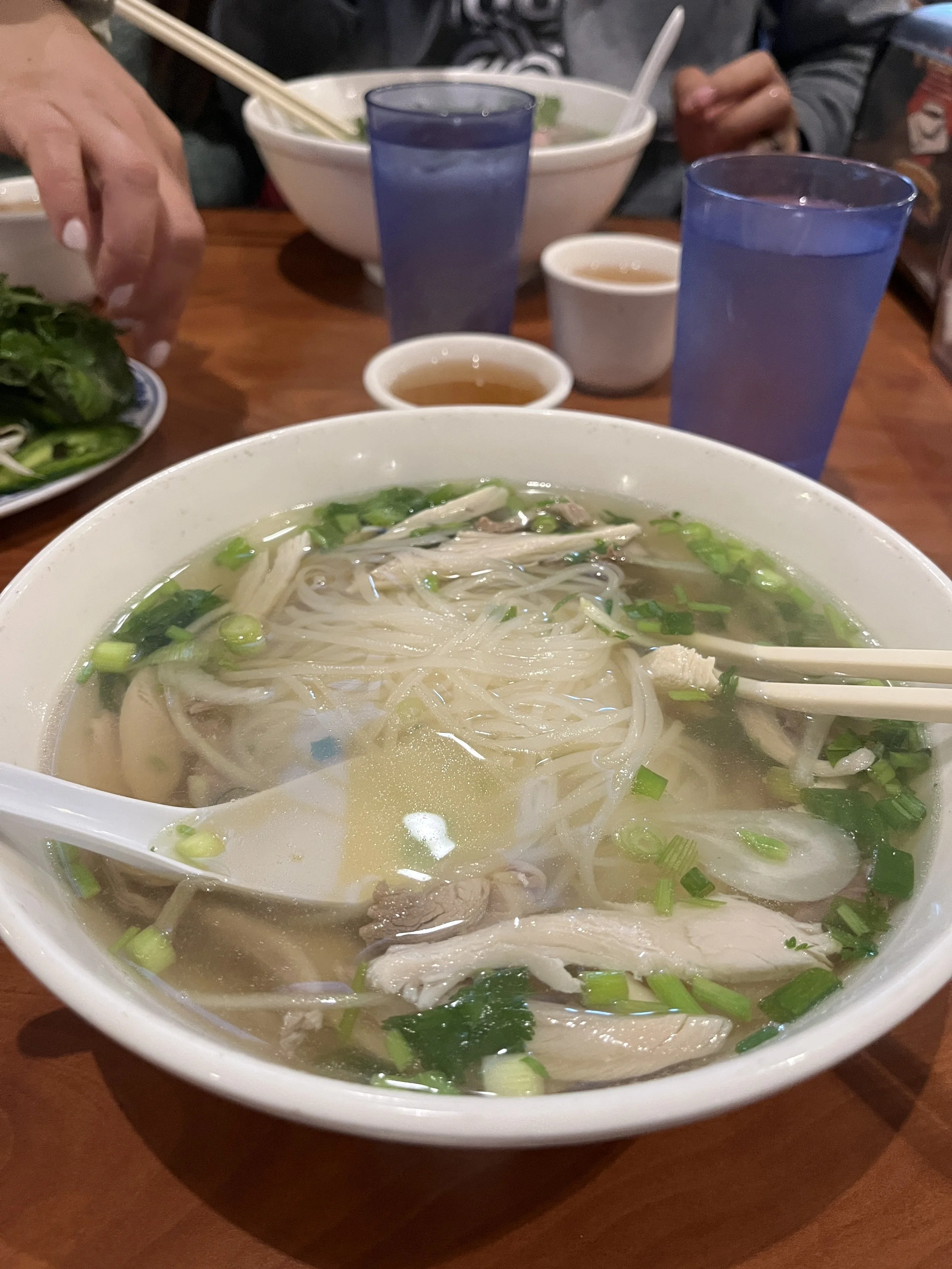
We took our time and spent close to three hours there somehow, leaving at around 7PM. Our final stop of the day was a restaurant in SF, called Kevin and Chris’s Noodle House. Prior to the trip, in the beginning stages of trip planning, Selena had made a list of places - sightseeing, nature, restaurants, bakeries - that she stored in her mind for when we come visit. When I first looked at the list, I didn’t think Kevin and Chris’s Noodle House was a real place. It turns out it is a real place, and she said it’s good, so, naturally, we had to go! There was a wait, the restaurant was crowded, clearly busy and popular, even though it was 8PM. It is a Vietnamese restaurant, and the food was good. Good job, Kevin and Chris!


After dinner, Selena dropped us at the hotel, we said our goodbyes, as Kevin and I were leaving early the next morning. We packed up our bags and wrapped up our trip! Kevin and I left the hotel at 7AM the next morning, but Chris was staying another two days. SFO airport is 25-30 minutes from the city. We got breakfast/lunch at the airport, at another Vietnamese place called Bun Mee - it was expensive but good and hit the spot. (Side note: there is a lot of good Vietnamese food in SF and LA).
This trip was a great getaway and a nice mix of sightseeing in the city, spending quality time with my sister and unwinding in nature.
A Note on Safety
Prior to our trip, we implemented our safety protocols. We notified our emergency contacts of the dates of our backpacking trip, the trailhead, our itinerary, where we expected to be each night - things of that nature. We have a Garmin inReach, satellite communication device. Unlike a phone, it connects via satellite, allowing you to send messages, track your location, and most importantly, call for help in an emergency. We used our inReach to check in with emergency contacts each night and to let them know where we were and that we were all okay. I learned after that even though I didn’t use the “check in feature” (side note: I had leant the device to a friend and while I changed the emergency contacts with Garmin, I failed to change who the check-in messages would be sent to), and instead sent a message to our emergency contacts each night, a link accompanied my message with a map and a pin of my location. Neat!
An important note, brought to our attention because in our group chat with our emergency contacts prior to embarking, my sister told them that her friend in SF has her AirTag location. AirTags are great in cities or populated areas, but they’re nearly useless in the backcountry. That’s because AirTags rely on nearby Apple devices to relay their location back to you. AirTags don’t have GPS or any way to connect directly to satellites or cell towers. In the backcountry, where there is no cell signal and few other Apple devices, this will not serve as a way for someone to find you if you are lost. Always play it safe with letting someone know your itinerary and use a satellite communication device - and hope you don’t need to use it!